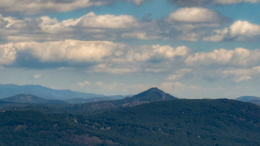
The second-tallest summit in Georgia provides awe-inspiring, panoramic views. But as if standing on the actual Rabun Bald peak at 4,698 feet was not enough of an aha moment, a fire tower rising around 20-plus feet offers spectacular vistas in every direction.
The fire tower, officially located within the Chattahoochee National Forest in Rabun County, Georgia, is accessible from two trails off Hwy 106 (Dillard Road, also referred to as Scaly Mountain Road) – for anyone coming off the Plateau from Highlands. Another trail begins at Warwoman Dell near Clayton, Georgia.
Whether a seasoned hiker or just a meanderer, you can get there. In fact, there is a short trail, a bit longer trail, and much longer trail. Thus, three options.
The shortest route starts at the Beegum Gap trailhead in the Sky Valley neighborhood. Turn onto Kelsey Mountain Road from Hwy. 106 and the trailhead is at the end of the Beegum Gap gravel road. When parking, be sure to not block anyone who might live there. Once on this approximately three-mile trail, roundtrip, follow the green blazes for about .2 miles on the access trail until you get to the Bartram Trail, which is marked by yellow blazes.
A slightly longer trail starts at the Hale Ridge trailhead on the Bartram Trail. Take Hale Ridge Road from Hwy. 106 and follow it until you see signs for the Bartram Trail; turn left, drive to the trailhead, and park on the side of the road. Follow the yellow blazes on the Bartram Trail until you get to Rabun Bald. This trail – out and back – is about five and a half miles.
 Finally, for anyone desiring a significant workout and an overnight pack-in camping experience, drive to the Warwoman Dell trailhead near Clayton, Ga. Get on the Bartram Trail and follow the signs to Rabun Bald. You can expect to hike nine to 10 miles there – so, obviously double that to factor the round-trip mileage. This trail option’s bonus is that you will enjoy a view of a waterfall shortly after heading out on the hike.
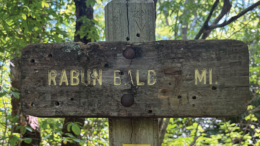
Along the well-maintained trails are carved wooden signs or sometimes carved rocks indicating the distance to Rabun Bald. Regardless of which trail you take, you are going to ascend gradually. Your destination is, after all, a bald – which basically means a mountaintop that is covered mostly in grasses or bushes instead of tall trees. Although the apex of this adventure is the actual view from the top of the tower, hikers are rewarded on the trail with foliage all times of the year – whether lush rhododendron tunnels, centuries-old towering trees, vibrant green mosses, bright berries, and multi-shaped and hued mushrooms.
Look closely at the tower, built in the 1930s by the Civilian Conservation Corps; initials are etched into the tightly stacked-stone base. Although the tower was used by the United States Forest Service until the 1970s, it has been an observation tower since then. Do not be surprised to find people proposing, having a picnic, taking panoramic photographs, painting plein-air, or even practicing short-range radio procedures from atop this tower.
Consider downloading an app on a smartphone such as PeakFinder to know which mountains can be viewed from the Rabun Bald fire tower. For instance, anyone living on the Plateau will be interested to know that the very pointed summit in the distance is Whiteside Mountain.


Favorites Count: 0